| Home :: Hill Stations in Kerala |
|
| Hill Stations in Kerala |
|
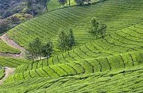
Much of kerala's exotic appeal is centred in the highland area of the Western Ghats. Rising to an average height of 1520 m, the tropical forests of the Ghats house is rich in flora and fauna. Not to speak of expansive, loamy plantations of tea, coffee, rubber and fragrant cardamom.
|
| Devikulam |
|
|
7kms from munnar, this idyllic hill station with its velvet lawns, exotic flora and fauna and the cool mountain air is a rare experience. The sita devi lake with its mineral waters and picturesque surroundings is a good picnic spot. The lake is also ideal for trout fishing.This gorgeous hill station symbolises nature in her pristine glory. The crisp and cool mountain air heavily laden with the fragrance of wild flowers and rare herbs is any nature lover's paradise. Irresistibly green slopes touching the sky at a thousand metres. Silent clusters of slender red and blue gum trees. A lovely, little lake hidden within the rolling hills. This is Devikulam.
|
|
| Munnar |
|
|
Located in the hill ranges of Kerala 1600 m above the sea, where three mountain streams - Mudrapuzha, Nallathanni and Kundala - come together. Munnar is a vision in green. Some of the highest tea estates in Kerala can be seen in Munnar, as the hills surrounding this scenic town are carpeted with tea bushes, spice plantations and greenery.There are also opportunities for nature walks, trekking and bird watching tours in Munnar. There are wild animals to spot, golf to be played, some trout fishing to be done. Trek through the green gardens and if lucky, you can even spot a pack of wild elephants, play a round of golf in the afternoon and engage your evenings doing some leisure fishing before lazing by the bonfire in the night and sipping a cup of fine Malayali tea. One can also visit the nearby tea museum, housing an interesting array of relics and artifacts from the past as well as several historic photographs and pieces of period furniture. Run by Tata Tea, this museum surely provides an insightful and educative experience to a layman.
|
 |
|
| Ponmudi |
|
This hillstation in the Western Ghats, located around 65 km from Thiruvananthapuram, is a picturesque getaway in Kerala. The green hills, with winding roads, pretty cottages, and an abundance of birds and butterflies flying through the spice plantations and tea estates, make it an idyllic Kerala tourism destination.Ponmudi (meaning the Golden Peak in Malayalam) is the least haunted by tourists and therefore the most peaceful of all Kerala hill stations. Embellished with rapids flowing over the road, and misty peaks thronged by an exotic vegetation, Ponmudi is a hiker's and trekker's paradise. Hike through the slopes of tea gardens to watch the pickers at work or fish in the emerald waters of the Kallar River to make the most of Ponmudi.
|
|
|
|
|
Kalpetta
|
|
|
This is the district headquarters of Wayanad, is the only municipality in this hilly region. The town has hotels, bars, restaurants and shops, making it a convenient base to visit this place while at the same time enjoying these facilities. It is a small town surrounded by dense coffee plantations and mountains, is the headquarters of Wayanad district. The town is a major hub to all the tourist destinations in Wayanad.
|
|
It has standard hotel accommodations. It lies on the Kozhikode-Mysore National Highway (NH 212) at an altitude of about 780 m above sea level and at 11.6 degrees latitude and 76.1 degrees longitude.
|
|
|
|
Sultan Bathery
|
|
|
This is a mid-sized town in Wayanad district of Kerala, India. It derives its present name from Tipu Sultan of Mysore who used the abandoned Jain temple here and used it as his battery here in the 18th century, hence the name Sultan's Battery.Old name of this town was Kidanganadu,because the presence of the Kidangans the tribes. Later, it came to be known as Sultan Bathery, the Malayalam version of its name. It is also known as Sultan's Battery of Wayanad district. Though the fort does not remain any more, the place is worth the visit for the famous Jain Temple. The place was previously known by the name of Sulthan's Battery. The town is the largest town in Wayanad District.The largest being the Taluk headquarters of Sultan Bathery .
|
|
It lies on the Kozhikode - Kollegal National Highway (NH 212) 98 km from Kozhikode town. It is 115 kilometers from Mysore and about 100 kilometers from Ooty (Udagamandalam). It is also connected with Nilambur. The people primarily depend on agriculture for a living. Sulthan Battery is situated at about 930 metres above mean sea level. One can find beautiful folded hills across the horizon. The climate is pleasant throughout the year. The town has the National Highway 212 passing through it. The town is the centre of tourism in Wayanad District. It has become a very popular destination among tourists from India's software valley.
|
|
|
|
Vellarimala
|
|
|
This forms a part of a high hill range of what is otherwise known as Camel's Hump Mountains, a part of the Western Ghats. Most of the hill range falls in the Meppady Forest Range of South Wayanad Division, with some parts falling in the Thamarassery Range of Kozhikode Division. They are semi-contiguous with Nilgiris or Nilgiri Hills in Tamilnadu, separated by the Chaliyar Valley. The plateau of Wayanad lies on the eastern slopes of these hills and merges gradually with the Mysore plateau. The hill ranges are accessible by foot from Muthappanpuzha, near Anakkampoyil, a small town about 50 km from Kozhikode. About 6 km by foot from Muthappanpuzha on the way to Vellarimala hills is the waterfall called Olichuchattam.
|
|
It is situated 15 km from Thiruvambady. KSRTC Bus Services are available from Thiruvambady to Anakkampoyil and Muthappanpuzha. Swargam Kunnu is also situated here.Vellarimala - Swargam Kunnu - Olichuchattam - Marippuzha - Muthappanpuzha Trucking is available.Now road is available from Thiruvambady to Marippuzha. This block of compact high mountains is floristically and faunistically similar to the Nilgiri Hills. The tallest peak in this range is called Vavul Mala. At an altitude of 2339m, it is the tallest of the Western Ghats to the north of Nilgiri Hills.
|
|
|
| Peermedu |
|
|
Located 915 m above sea level, at a distance of around 40 km from Kumily in Idukki district of central Kerala, this beautiful hill station in the Western Ghats is known for its green landscape. Clouds drop gently on the peaks that flank the verdant slopes of Peerumedu. Rich with mile upon mile of plantations falling away in precise steps. The green slopes of the region are also the perfect place for newly weds to be if they are keen on a honeymoon in Peerumedu. Surrounded by rich plantations of tea, coffee, cardamom, rubber and eucalyptus, the entirety of Peerumedu is enveloped with a fragrance that is heady and delightfully intoxicating!
|
|
|
| Thrissanku and Peeru Hills |
|
|
Located 4 km from Peermede, half a km from Kuttikanam. The landscape here is breathtaking with rolling hills and a gentle breeze caressing. A perfect spot to un wind and to go for long walks.. The spectacular view of the sunset and sunrise from these hills is simply awesome. Thrissanku is perfect spot to go for a long walk. The landscape here is breathtaking with rolling hills and a gentle breeze caressing. The amazing view of the sunset and sunrise from these hills is simply awesome. . Peeru Hills is true haven for trekkers and picnickers.
|
| Echo Point |
|
|
Located 13 km from Munnar, Echo Point is a popular adventure tourism destination. Trekking and nature walks are popular activities in this scenic destination with beautiful views of the green hills. The scenic place gets its name from natural echo phenomenon. Visitors can enjoy by making howl against the reservoir, nature will answer with an echo. This nature response to a human call can not be seen anywhere else in Kerala. Climate is pleasant,cool and misty,though heavy showers are common between June-september which gives it a very fresh feel. An excellent place, especially for young travelers to disembark for a while, yell out and listen to your voice coming back to you!
|
| Ramakkalmedu |
 |
|
Located at a distace of 16 km from Nedumkandam on the Thekkady-Munnar Road, Ramakalmedu is a beautiful hill station, which offers fresh mountain air and pleasant views of gentle hills all around. Rolling green hills and the fresh mountain air make Ramakalmedu and enchanting retreat. The hilltop also offers a panoramic view of Tamilnadu towns.The sight is even wonderful if you could stay there till dusk and see all these towns lighted. Its still beholds the virginity of the mountains and forest as there is not much encroachments by the humans other than the few settlers who came just after the formation of the State. During Monsoon, it is mostly raining with strong winds and evenings are colder. Trecking becomes more adventurous and rain gives the forest and mountain more colour and beauty, its really marvelous to see the rain (probably to have a rain dance) on the mountains of Ramakkalmedu. From November to February its like a paradise with beautiful sunshine.
|
|
|
| Wayanad Hill Station |
|
|
Luxuriant plantations of coffee, tea, cardamom, pepper and rubber stretch over the hills of Wayanad as far as the eye can see., With the fast-flowing rivers- Panamaram, Mananthavady and kabini- cutting across the undulating panorama and lending picture-postcard look to the whole region. The literary society endorses that Wayanad has derived its name from the words 'Vayal Nadu' - meaning, the village of paddy fields. Previously the region was ruled by the Rajas of the Veda tribe and later by the Pazhassi Rajahs of Kottayam royal dynasty.
|
|
| Edakkal Caves |
|
|
The two rock vaves at Ambukuthy Hills, 12 kms south of Sultan Battery (travel time: 20 min), contain ancient carvings and pictorial writings with human and animal figures in peculiar headers along with geometric form and symbols.They speak of a highly civilized people at an early centre of human habitation. . What makes it a cave to the ordinary observer is the fact that in the other portion of the large cleft, an enormous rock, weighing several tonnes, has fallen forming a roof over a large part of it. The caves, located on an ancient route connecting the high ranges of Mysore to the ports of Malabar, are a source of mystery to archeologists. Though the origins of the engravings in the cave (generally depicting images of tribal kings, queens, elephant, deer and wheeled carts) are still unknown, but they are attractive enough to entice a visitor. The cave immortalises the memory of a tribe that hunted in the forests, tamed and bred animals, and farmed on the hill sides.
|
|
|
|
| Thirunelly |
|
|
At just 32 kms from Mananthavady (travel time; 1 hour ), the eye-catching backdrop of Brahmagiri hills lend an idyllic charm to Thirunelly where the Vishnu Temlple touched by the soothing streams of Papanasini provides eternal bliss to the searching pilgrim. It is popular for two things pilgrimage and tourism. To be a bit more specific , the ancient temple at Thirunelli is known for rites that is offered to the departed souls. Also for tourism, its a birders delight and trekkers paradise . The temple is located on to of a hill that is surrounded by mountain ranges all around. In other words the temple sits hidden in the middle of a secluded forest . The temple faces east where sun raises over the Udayagiri range.
|
| Pookot Lake |
|
With its own dream-like serenity, this natural fresh water lake surrounded by meadows and trees on all sides is a heaven for peace-seeking travellers. You'll find it on your way from Calicut half an hour ahead of kalpetta. It is a natural fresh water lake surrounded by evergreen forests and rolling hills. Boating in the Pookot Lake is a memorable experience. Tall trees and dense forests that line along the pathway around the lake provide a visual treat. A freshwater acquarium with a large variety of fish is an added attraction. Tourists can also avail of boating facilities, to enjoy the serene waters of the enchanting lake. A children park and a shopping centre for handicrafts and spices are some of the few attractions of the region, providing recreational facilities to the visitors.
|
|
| Mananthavady |
| Historically important as the last resting place of Pazhassirajah who fought a guerilla war against the British. It is a small town on the banks of Mananthavady Puzha a tributary of the Kabini River in the Wayanad district of Kerala, India. This area was ruled by the Pazhassi dynasty and the tomb of Pazhassi Raja is an important heritage site located in the heart of the town. Valiyoorkavu is a small temple that is located around 3 km from the town and this is one of the most important temples in the area, especially among the tribal people and many tribes congregate in this place. |
|
|
|
| Nelliyampathy Hill Station |
|
Located just 75 km from Palakkad and at an altitude of 467m to 1572m above sea level. Nelliyampathy has immense trekking potential. This place is also known for its rich plantation of spices and coffee as well as its rich evergreen forests. Nelliyampathy perhaps the loveliest of the un-spoilt hill stations of Kerala. The best time to take a tour to Nelliyampathy is from April to September. Estates of tea, coffee, orange and cardamom dot the ranges. The ranges here consist of a chain of ridges cut offf from one another by valleys. The highest peak is Nellikota. The forest contains teak of extraordinary height and girth.
|
|
|
|
| Vagamon |
|
Vagamon, at an elevation of 1100 m above the sea level is at an accessible distance of 100 km from Cochin and 60 km from Kottayam. It is a paradise for the seekers of peace and tranquility and abundance of nature. The hill station is surrounded by tea estates and will soon become India's foremost Eco-Tourism Projects. The hill station is a amalgamation of natural beauty, religious mysticism and colonial legacies. Vagamon is surrounded by three chain of hills, namely, Thangal hill, Murugan hill and Kurisumala.This enchanting hill station is dotted with tea gardens and meadows.This is one of India's foremost eco-tourism projects. The breeding centre Kerala Livestock Board is located here.Vagamon hill station is comprised of a beautiful series of hillocks, valleys and cascading waterfalls that make it the ideal getaway for tourists. Take a walk along the narrow, mist covered zigzag roads that wind up the hills and experience true bliss. For adventure seekers, there is an option of trekking, para gliding or rock climbing. The hill station has a chain of 3 beautiful hills called Thangal hill, Murugan hill and Kurishumala that give an enchanting feel to this beautiful hill station. So visit Vagamon hill station to experience eternal bliss and peace of mind. The peaceful surroundings with cool and soft breeze blowing across the valley makes it a perfect place for meditation.
|
 |
| |
| |
| |
|
|
|